
Hoi An Flooding: Which Streets Go Under, What Closes and How to Rebuild the Day
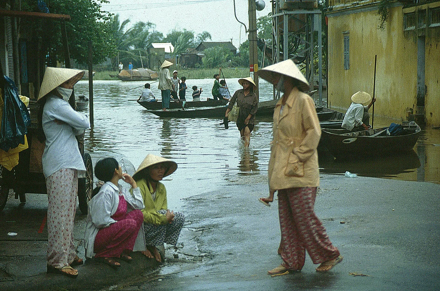
Hoi An’s old town floods from the quay inwards, one block at a time. The water is usually gone in a day or two, and the things that shut first are the ones you pay to walk into.
| When | October and November, inside a flood-season window that runs 1 September to 15 December |
|---|---|
| The order | From Bach Dang on the quay, one block inland at a time |
| The number | 1.5m on the Hoi An gauge is alert level 2, 2.0m is level 3 |
| What shuts first | The ticketed interiors: merchant houses, assembly halls, museums |
| Boats | Pleasure boat rides during a flood are banned outright |
| How long | A day or two of water |
1. What a flooded day actually removes from your trip
2. The streets go under in a fixed order
3. Reading the gauge: the two numbers that matter
4. The rain that decides this falls upstream, not in Hoi An
5. What closes, and what never cost anything anyway
6. Boats through the flooded lanes are banned
7. How long the water takes to recede, and the days after
8. Where you sleep matters most in the wet months
9. Rebuilding the day you lost
10. What to check before you book
1. What a flooded day actually removes from your trip
When the water comes into Hoi An, what you lose is the part of the town that has a ticket price on it. The rest of it stays where it is. The ancient townMap fills from the river inwards, and the buildings you pay to enter close before anything else does. Walking, eating and photographing were never charged for, so they return as soon as the water drops.
That changes the question. It is rarely worth cancelling Hoi An. It is almost always worth moving what you had booked for that particular day.
| How you are travelling | What a flood day does to it | The useful response |
|---|---|---|
| Staying in the old town | Getting out of the building becomes the problem | Your address decides nearly everything |
| Staying at the beach, visiting town | Only the trip into town is cut | The sea is closed this season anyway |
| Based in Da Nang, day-tripping | You lose that one day whole | Trade it against a Da Nang day |
| Cooking class or basket boat booked | The session itself is usually cancelled | Check the reschedule terms before you pay |
| Clothes being made | Fittings and collection slip | Leave a spare day between fitting and pickup |
| Long stay, flexible dates | Two days of disruption, then normal | Waiting is a real option here |
If the room is not booked yet, position beats star rating in these months. One block back from the water, and a room that is not on the ground floor, changes the whole experience. The zones are compared in the Hoi An accommodation guide.
2. The streets go under in a fixed order
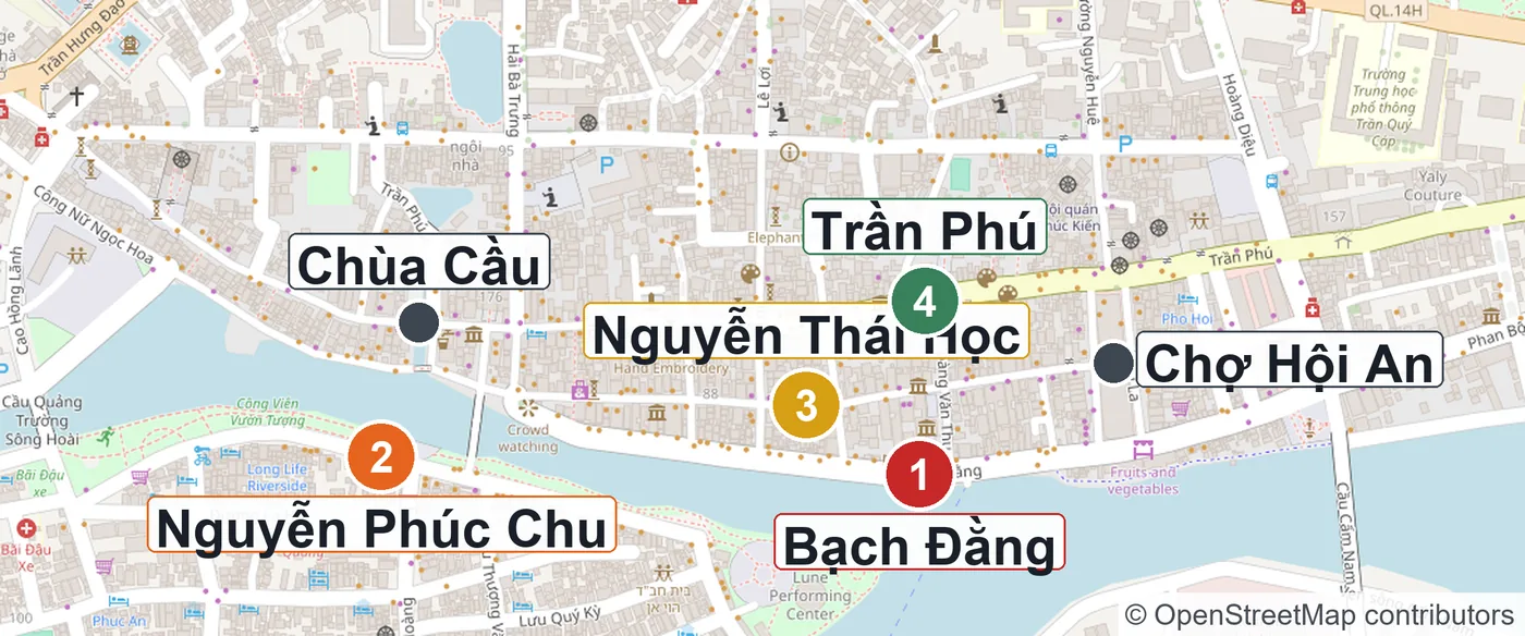
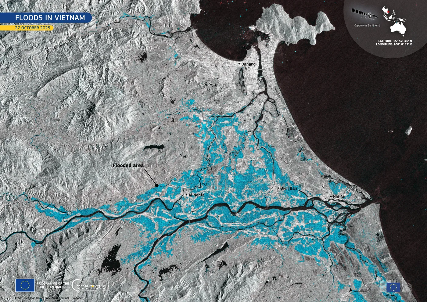
Hoi An sits in a low pocket near the mouth of the Thu Bon. Water does not appear randomly across the old town. It comes over the quay and works inland one block at a time, which means a single photograph is enough to tell you which stage the town is at.
| Stage | Street | Where it is | What is happening by then |
|---|---|---|---|
| 1 | Bach Dang | The quay itself | Riverside cafes and stalls carry stock inland |
| 2 | Nguyen Phuc Chu | The An Hoi bank opposite | The walk towards the night market is cut |
| 2 | Cong Nu Ngoc Hoa | West of the covered bridge | The pavement goes under |
| 3 | Nguyen Thai Hoc | One block behind Bach Dang | Water enters the ground floors of the merchant houses |
| 4 | Tran Phu | The next block back | At this point the whole old town counts as flooded |
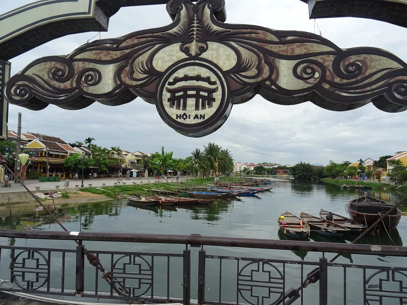
By that stage the water has also reached the Japanese Covered BridgeMap. Nguyen Thi Minh Khai and Nguyen Hoang usually appear in the reports alongside them.
Depths on the street vary enormously between events. These are measured from the road surface, which is a different number from the river gauge readings below.
| Event | On the quay | Inner lanes |
|---|---|---|
| November 2017 | Over 2m on parts of Bach Dang | Over 1m |
| Night of 28 October 2025 | 2.5m | The deepest of that year’s three |
| Morning of 17 November 2025 | 0.5 to 1m | Third flood in three weeks |
| 18 November 2025 | 1.2 to 1.5m | 0.8 to 1m |
One block is genuinely the difference between a shop that is trading and a shop that is shut. Getting around on foot is covered in more detail in getting around Hoi An.
3. Reading the gauge: the two numbers that matter
These floods are not silent. The Thu Bon is gauged at several points and the readings move from upstream down, so there is warning built into the geography. For a traveller that gap is the time to move a bag upstairs or move a booking.
| Station | Alert level 2 | Alert level 3 | 1964 peak | 30 October 2025 |
|---|---|---|---|---|
| Hoi An | 1.5m | 2.0m | 3.40m | 3.39m |
| Cau Lau, upstream | not published | 4.0m | 5.48m | 5.62m |
Two numbers cover most situations. On the Hoi An gauge, 1.5m is alert level 2 and 2.0m is alert level 3. On the evening of 1 November 2025 the town read 1.5m, and around those days Bach Dang, Nguyen Thai Hoc and Tran Phu were carrying half a metre to a metre of water.
There is also a ceiling to compare against. The 1964 flood peaked at 3.40m here and the water stayed up for a week, which is still the twentieth century benchmark. On 30 October 2025 the town reached 3.39m, one centimetre under it. Upstream at Cau Lau the same flood hit 5.62m, twelve centimetres above the 1964 mark. Upstream moves first and moves further.
Further up again, Nong Son and Ai Nghia both passed alert level 3 in the same hours. The order to check is the upstream stations, then Cau Lau, then Hoi An.
4. The rain that decides this falls upstream, not in Hoi An
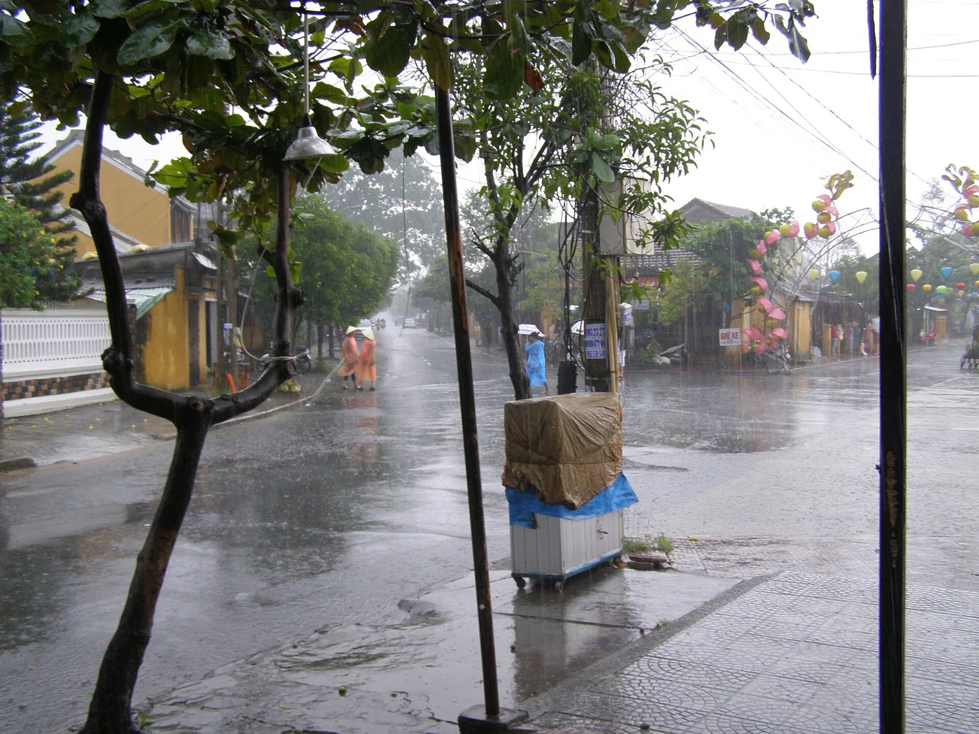
Here is the part that catches people out. The sky over Hoi An can be clear while the old town is filling. The rain that matters lands in the hills west of here and takes time to arrive down the river.
Two other things stack on top of it: releases from the hydropower reservoirs above, and the tide at the river mouth. Hoi An’s own heritage conservation centre describes the town as the place where water off the mountains meets a rising sea, and names deforestation and dam building among the reasons recent floods run higher.
Because of that, the season has a legal boundary rather than a felt one. The joint reservoir operating rules for the Vu Gia and Thu Bon basin define the flood season directly.
| Item | Rule |
|---|---|
| Flood season window | 1 September to 15 December each year |
| Reservoirs covered | A Vuong, Dak Mi 4 and Song Tranh 2 |
| Priority order | Dam safety first, then reducing the flood downstream, then power generation |
| Release principle | Gates must be worked so that no sudden artificial flood is created downstream |
| Warning | Alarm systems notify communities below the dams before a release |
Monthly rainfall puts October and November in the 400mm range, the two wettest months of the year. Rainfall alone does not explain two metres of water in a street, though. It takes several days of it arriving at the same time as the releases. The wider seasonal picture is in the Da Nang rainy and typhoon season guide, with the month pages at Da Nang in October and Da Nang in November.
5. What closes, and what never cost anything anyway
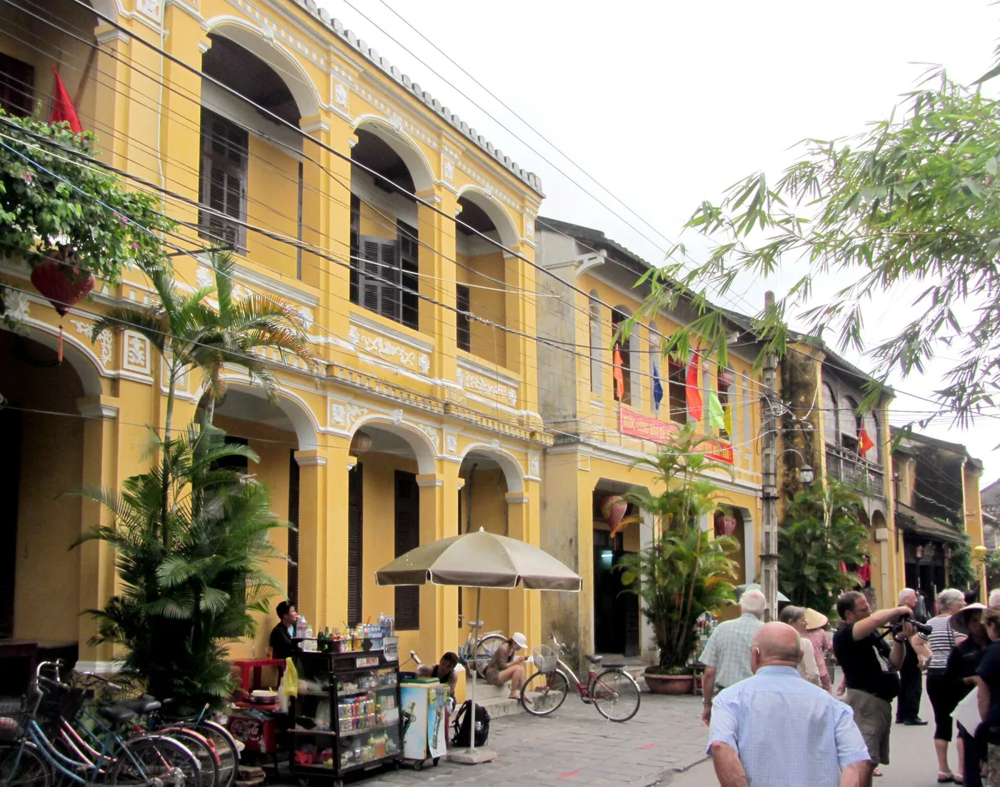
The structure of the old town ticket explains the loss better than any list of closures. It is 120,000 VND for foreign visitors, valid 24 hours, and it buys five tear-off coupons for five of roughly 22 protected sites: the assembly halls, the merchant houses, the small museums and the covered bridge.
Which means walking the lanes, crossing the bridges, browsing the night market, eating and photographing the lanterns were never part of the ticket. The line between what collapses in a flood and what survives it runs almost exactly along that boundary.
| While the water is in | After it drops | |
|---|---|---|
| Old town ticket sales | Suspended | Resume once the cleaning is done |
| Merchant houses, halls, museums | Closed | Reopen in stages, by damage |
| Thu Bon boat tours | Suspended | Resume as the level falls |
| Craft villages and countryside | Cut off | Reopen once the silt is cleared |
| Walking and the lantern-lit evening | Dry blocks only | Back immediately |
| Restaurants and cafes | Upstairs service or closed | Usually quick to return |
| Tailors | Benches move to the first floor | Collection dates slip |
In the late October 2025 event, tourism in the old town stopped for four to five days from the 27th. One tour operator reported 30 to 40 percent of customers cancelling or postponing; another put it at 15 to 20 percent. Around 5,000 room nights were cancelled at the higher end of the hotel market.
Nearly everything in the lost column had a booking attached. Session-based experiences go first, so cooking classes and the basket boat are the usual casualties, along with anything out of town like Tra Que herb village. If a tailor is making something for you, build a spare day in before you fly.
6. Boats through the flooded lanes are banned
Photographs of visitors being rowed down a submerged street circulate every year, and the travel web tends to present it as an experience worth having. Hoi An’s authorities have banned pleasure boating in the old town during floods outright.
| Question | The actual position |
|---|---|
| Is it allowed | No. A complete ban applies while the town is flooded |
| Who imposed it | The Hoi An ward administration, stated by its deputy chairman |
| The stated reason | The wash a boat makes acts on the foundations and structure of the old houses |
| Is it a tourism product | It has been considered and never approved |
| What approval would need | A full operating plan, guaranteed safety for residents and visitors, protection of community property |
| On the ground | Unlicensed rides are still offered and are being stopped |
| Price guidance | None exists. The activity is prohibited rather than regulated |
The practical case for declining is as strong as the heritage one. There is no published fare, no licence and no recourse if something goes wrong in moving water. Other situations worth recognising are collected in the guide to common travel traps in Vietnam. Note that the basket boat is a separate, properly licensed activity in normal conditions; the ban is about boating through the flooded streets.
Water activity stops more broadly in these weeks. The Cu Lao Cham day trip does not sail for much of the wet season, though that is about sea state rather than the river.
7. How long the water takes to recede, and the days after
In most events the water is gone within one to two days. Hoi An’s heritage centre gives the same figure. This is the single most useful fact for anyone holding a booking: a whole week is rarely lost, a specific day usually is.
| Phase | How long | What is possible |
|---|---|---|
| Rising | Hours to a day | Upstream gauges give you notice |
| Water in | Usually 1 to 2 days | Dry blocks and first-floor service |
| Falling | About a day | Streets reappear in reverse order |
| Silt and debris | Several days | Businesses reopen in sequence |
| Tickets back on sale | After cleaning | The interiors open again |
The complication is repetition. In 2025 the old town flooded three times in the twenty days from late October, and residents describe years with four inundations inside a fortnight. Planning Hoi An into a wet-season trip works much better with two days of slack than one.
Repeated soaking leaves a mark. Timber merchant houses weaken each time, and in 2025 some were reported at risk of collapse. Expect a few sites to reopen late after safety checks even once the streets look normal.
8. Where you sleep matters most in the wet months
Two people in the same town on the same night can have completely different weeks. Two variables account for nearly all of it: which zone, and which floor.
| Zone | In a flood | Trade-off this season |
|---|---|---|
| Bach Dang and the quay | First to go under, and deepest | The best outlook in the town, the rest of the year |
| One block back | Depends on the stage | Walkable, moderate exposure |
| North of the old town | Affected later, if at all | A longer walk in |
| An BangMap | Only the trip into town is cut | The sea is not swimmable now |
| Cua DaiMap | Similar | Red flags mean no entry to the water |
| Da Nang | Varies sharply by ward | Far more indoor alternatives |
The beach is not the escape it looks like. An Bang and Cua Dai are unsuitable for swimming from October through January because of surf, rip currents and onshore wind, and in November 2025 storms tore out beach infrastructure and washed away eight kilometres of shore. The swimming season here is March to September. The two beaches are compared in the An Bang and Cua Dai guide.
Moving to Da Nang is not automatic either. On 29 October 2025 ten communes and wards in Da Nang were cut off and 15,886 people were evacuated, with some areas more than two metres deep. What Da Nang does have is variation: the low-lying wards and the coastal hotel strip behave differently, so options remain. The zones are set out in the Da Nang accommodation guide.
9. Rebuilding the day you lost
Emptying the day is the worst option. Most of it can be moved rather than deleted.
| Alternative | Where | Watch for |
|---|---|---|
| Museums and indoor collections | Da Nang | Open regardless of weather |
| Massage and spa | Da Nang, or dry blocks of Hoi An | Booked out quickly on wet days |
| Covered markets and shopping | Da Nang | Only the journey is the problem |
| A day built around eating | Either town | Find the first-floor rooms in advance |
| Hot springs and indoor pools | Outside Da Nang | Check the road first |
| My Son | Inland | Closes too if the rain is sustained |
What is worth doing in Da Nang under rain is collected in Da Nang when it rains, and pairing it with things to do in Hoi An makes the swap easier to assemble. My Son sits inland and behaves differently, so check conditions on the My Son day trip page.
On some days the journey itself is the whole problem. Da Nang to Hoi An is around 30km, and when roads are under water ride-hailing gets scarce and fares climb. A car booked for a set time is worth more than usual on those days. The normal options are all in getting from Da Nang to Hoi An.
10. What to check before you book
A short list to run through before confirming anything in these months.
| Check | How | Why it matters |
|---|---|---|
| Upstream alert levels | Nong Son and Ai Nghia, then Cau Lau | They move before Hoi An does |
| The Hoi An gauge | 1.5m and 2.0m are alert levels 2 and 3 | Tells you whether the old town is in it |
| Da Nang rain and flood warnings | Da Nang city announcements | Hoi An has been part of Da Nang since 2025 |
| Reservoir release notices | Between 1 September and 15 December | Levels can rise after the rain stops |
| Your room’s position and floor | Ask the property directly | Same town, very different night |
| Reschedule terms on sessions | The operator’s policy | You want a date change, not a refund fight |
| Natural disaster cover | Your policy wording | It is what pays for the changes |
One administrative note that affects where the information comes from. On 1 July 2025 Quang Nam province was merged into Da Nang, and Hoi An became a ward of the city. Warnings and flood notices now carry Da Nang’s name rather than Quang Nam’s.
For the wider timing question see the best time to visit, and for what to bring in the wet months the packing list is more use than a forecast. To rearrange the days themselves, the Hoi An itinerary and what to eat in Hoi An slot together well.